-
 The levee section is approximately 1.15 miles in length, from approximately 330 feet upstream of the Ysleta- Zaragosa International Bridge.
 -
 Wilson & Company conducted a predesign topographic survey of elevations of the levee, existing structures, and any other features along the levee.
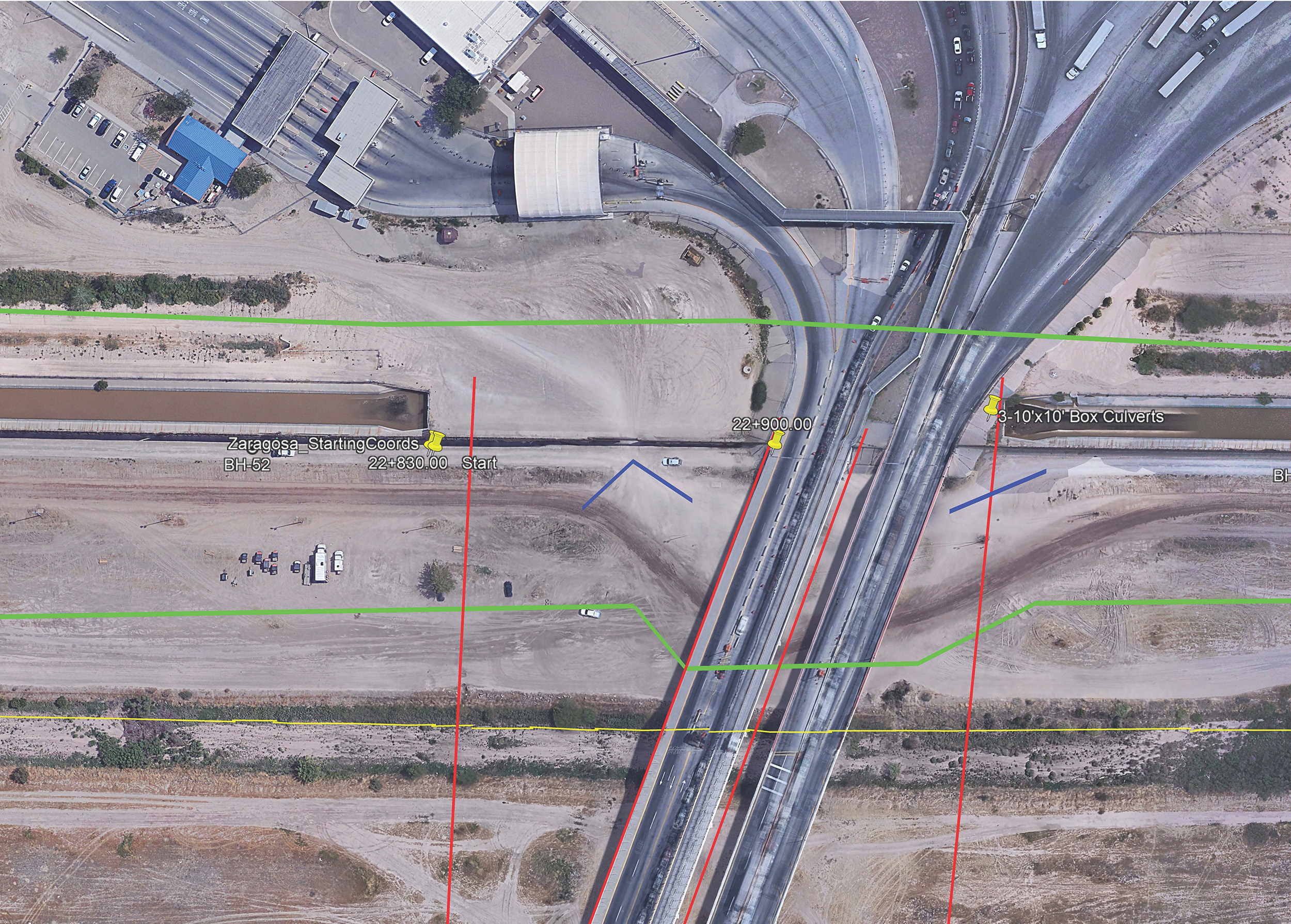
Rio Grande Rectification Project Zaragoza Levee
In 2006, the Federal Emergency Management Agency (FEMA) decertification of the USIBWC levees in El Paso County and Hudspeth County, Texas, resulted in public and local government pressure to upgrade the levees to FEMA criteria. This project, performed by Wilson & Company as part of the Wilson-Freese and Nichols JV, evaluated and designed repairs to the US section of the USIBWC levee in El Paso County, Texas. The levee section is approximately 1.15 miles in length, from approximately 330 feet upstream of the Ysleta- Zaragosa International Bridge to approximately 400 feet downstream of the old Riverside Weir.
Wilson & Company provides design services, design support, and surveying for this project. The new levee design will meet FEMA requirements found in 44 CFR §65.10 based upon the established 100-year design flood of 11,000 cubic feet per second (cfs). The levees will also meet the requirements of the US Army Corps of Engineers’ Engineering Manual (EM) 1110-2-1913, “Design and Construction of Levees.” The levee design will prevent the possibility of seepage from a Rio Grande flood from damaging panels within the Rio Grande American Canal Extension (RGACE) regardless of canal water levels. Design includes a finished gravel O&M road, three double ramps on the riverside of the levee designed as sections cut out of the levee instead of as roads skewed away from the levee, a wide turn-around area, and levee closure structures.
Wilson & Company conducted a predesign topographic survey of elevations of the levee, existing structures, and any other features along the levee, including headboxes, gates, DHS fence, gate wells, and bridges. Cross-section surveys were conducted at every significant feature or structure, at every location where the project starts and stops, and at a maximum of every 50’. Cross-section surveys were also conducted to support hydraulic modeling.